1

PPT Slide |
2

SRM tutorial |
3

Prerequisite |
4

Outline |
5

PPT Slide |
6

In the beginning ... |
7

PPT Slide |
8

Other interoperability examples |
9

Why is accuracy needed
for coordinate transformations? |
10

Target shooting at a visible target
in the real world |
11

Simulation of target shooting
at a visible target |
12

Servicing a non-visible target
in the real world |
13

Augmented Transverse Mercator(ATM) example |
14

SRM requirements |
15

Location is not enough |
16

The scope of the SRM |
17

It�s a Loooong way up |
18

The SRM encompasses
more than the Earth |
19

The SRM requires a shared solution |
20

SRM goals |
21

SRM concepts |
22

Key concepts
(Preview) |
23

Key concepts
(Preview) |
24

Key concepts
(Preview) |
25

SRM concepts |
26

Spatial objects and object-space |
27

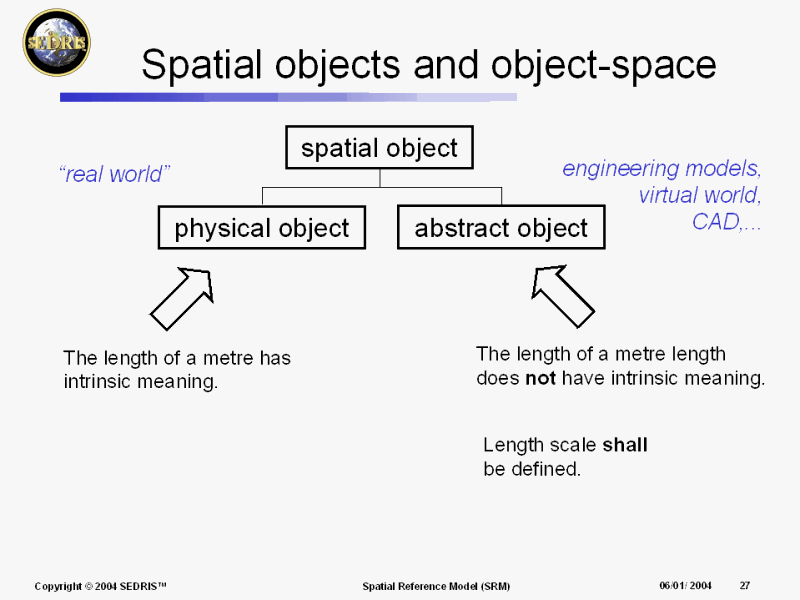
Spatial objects and object-space |
28

SRM concepts |
29

Position-space and embeddings |
30

Position-space and embeddings |
31

Position-space and embeddings |
32

Position-space and embeddings |
33

7 parameter transformation |
34

SRM concepts |
35

How are embeddings specified? |
36

Reference datums |
37

Reference datum (RD) |
38

Reference datum (RD) |
39

3D point RDs |
40

3D directed curve RDs |
41

Oriented surface RD (planes) |
42

Oriented surface RD (ellipsoids) |
43

Standard reference datums |
44

RD bindings |
45

RD bindings and embedding compatibility |
46

RD bindings and embedding compatibility |
47

Object reference models |
48

Object reference models |
49

Object reference model template |
50

ORMT example |
51

Realization of an ORMT |
52

3D ORMTs |
53

standard ORMs |
54

ORMT realization example |
55

Binding categories |
56

ORMs vs. object models |
57

SRM concepts |
58

Coordinate Systems (CS) |
59

Coordinates for position-space |
60

Coordinate system type |
61

Coordinate system characteristics |
62

Spherical CS specification
Part 1 |
63

Spherical CS specification
Part 2 |
64

Lococentric spherical CS |
65

Coordinate surfaces and curves |
66

Coordinate surfaces and curves |
67

Map projections |
68

Map projections |
69

Map projections |
70

Map projection distortion |
71

Map projections |
72

Azimuth |
73

Convergence of the Meridian |
74

Map projection as a surface CS |
75

Augmented map projections |
76

Augmented map projections |
77

Augmented map projections |
78

Geometry:
coordinate-space vs. position-space |
79

Standard coordinate systems |
80

Surface CS
induced on a coordinate surface |
81

Temporal CS |
82

Spatial coordinate systems |
83

Spatial coordinate systems |
84

Spatial coordinate systems |
85

Spatial coordinate systems |
86

SRM concepts |
87

Spatial reference frame (SRF) |
88

Spatial reference frame |
89

Celestiodetic SRF |
90

Celestiodetic SRF |
91

Local tangent space Euclidean SRF |
92

Local tangent space Euclidean SRF |
93

Local tangent space Euclidean SRF |
94

Local tangent space Euclidean SRF |
95

Local tangent space Euclidean SRF |
96

Local tangent space Euclidean SRF |
97

Local tangent space Euclidean SRF |
98

Local tangent space Euclidean SRF |
99

Canonical
Local tangent space Euclidean SRF |
100

SRF templates |
101

SRFTs for 3D object-space |
102

SRFTs for 3D object-space |
103

SRF example |
104

SRFTs for 2D object-space |
105

Reference vectors |
106

Reference vectors |
107

SRM concepts |
108

Earth surfaces |
109

Vertical offset model (VOM) |
110

Vertical offset model (VOM) |
111

SRM concepts |
112

Spatial operations |
113

Change of embeddings |
114

Change of embeddings |
115

Coordinate transformation |
116

Change SRF operations |
117

Coordinate conversion |
118

Change SRF operations |
119

Change SRF operations |
120

Spatial operations |
121

Abstract API |
122

SRM API |
123

SRM API object hierarchy (1 of 6) |
124

SRM API object hierarchy (2 of 6) |
125

SRM API object hierarchy (3 of 6) |
126

SRM API object hierarchy (4 of 6) |
127

SRM API object hierarchy (5 of 6) |
128

SRM API object hierarchy (6 of 6) |
129

SRM API non-object functions |
130

Abstract API examples |
131

Abstract API examples |
132

SRM API Implementation |
133

Computational considerations |
134

Error sources in spatial operations software |
135

Bounds checking |
136

Distortion and computation
error tradeoff |
137

How should accuracy be specified? |
138

Ground rules for spatial operations
algorithm development |
139

Ground rules for spatial operations
algorithm development (cont�d) |
140

Ground rules for spatial operations
algorithm development (cont�d) |
141

Ground rules for spatial operations
algorithm development (cont�d) |
142

Ground rules for spatial operations
algorithm development (cont�d) |
143

Ground rules for spatial operations
algorithm development (cont�d) |
144

Ground rules for spatial operations
algorithm development (cont�d) |
145

Spatial Operations
|
146

Quality assurance for spatial operations |
147

The meaning of accuracy is context dependent |
148

Conformance verification for the SEDRIS implementation |
149

Acceptance testing methodology |
150

The Structure of SRM ISO Standard
ISO/IEC 18026
(Committee Draft) |
151

Structure of the SRM ISO standard
(1 of 2) |
152

Structure of the SRM ISO standard
(2 of 2) |
153

SRM concept management |
154

Further reading |
. |
. |