 SEDRIS to CTDB and CTDB to SEDRIS Conversions Tutorial |
 Introduction |
 Introduction |
 Agenda |
 Compact Terrain Database |
 CTDB Format Terrain Surface Representation |
 CTDB Format Elevation Grid |
 CTDB Format TINs |
 CTDB Format Virtual Grid |
 CTDB Format Hybrid (grids and TINs) |
 CTDB Format Polygon Attribute Table |
 CTDB Format Polygon Attribute Table (cont.) |
 CTDB Format Soil Grid |
 CTDB Format SIMNET Mobility Word |
 CTDB Format Physical Features |
 CTDB Format Physical Features - Basics |
 CTDB Format Microterrain & Microwater |
 CTDB Format Volumes |
 CTDB Format Volumes (cont.) |
 CTDB Format MES |
 CTDB Format MES Structure Enclosures |
 CTDB Format MES Structure Apertures |
 CTDB Format Linear Features |
 CTDB Format Canopies & Aggregate Features |
 CTDB Format Laid Linear Features |
 CTDB Format Abstract Features |
 CTDB Format Abstract Features (cont.) |
 CTDB Coordinate Systems |
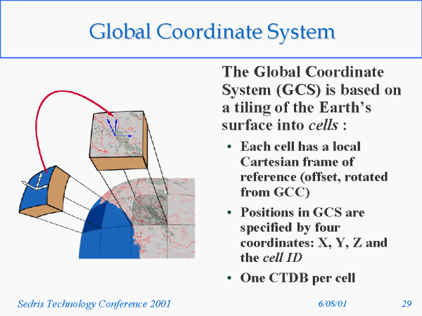 Global Coordinate System |
 CTDB Formats |
 CTDB Formats (cont.) |
 A Quick Review of Classification and Attribution in the SEDRIS DRM |
 Topics |
 Classification in SEDRIS DRM |
 Classification in SEDRIS DRM (cont.) |
 Attribution in SEDRIS DRM |
 Attribution in SEDRIS DRM (cont.) |
 Mapping from SEDRIS to CTDB |
 Topics |
 Features File |
 Features File Format |
 Features File Format |
 Data objects of features file |
 Filling the CTDB Header Data |
 Geoid Correctional Data |
 Topology |
 Elevation Grid |
 Elevation Grid (cont.) |
 Elevation Grid (cont.) |
 Triangulated Irregular Networks (TINs) |
 Soil Grid |
 Soil Grid |
 SIMNET Mobility Word CCTT to CTDB Mapping |
 SIMNET Mobility Word STGS to CTDB Mapping |
 SIMNET Mobility Word USGS to CTDB Mapping |
 Polygon Attribute Table |
 Physical Features � Microterrain/Microwater |
 Physical Features � Trees and Treelines |
 Physical Features � Canopies |
 Physical Features � Laid Linears |
 Physical Features � Aggregate Models |
 Physical Features � Volume Models |
 Physical Features � Volume Models |
 Physical Features � Volume Models |
 Physical Features � MES Structures |
 Physical Features � MES Structures |
 Abstract Features |
 Abstract Features |
 Spatial Reference Frames (SRFs) |
 SEDRIS to CTDB Compiler: How it works and how to use it |
 Topics |
 Compiler Operation - Overview |
 Compiler Operation Phase 1 and Phase 2 |
 Compiler Operation Phase 3 |
 Compiler Operation Phase 3 |
 Using the Compiler System Requirements |
 Running the Compiler |
 Running the Compiler |
 Running the Compiler |
 CTDB Recompiler Tool |
 Other CTDB Tools |
 SEDRIS Tools |
 Mapping from CTDB to SEDRIS |
 Topics |
 libCTDB API |
 PAT (Polygon Attribute Table) |
 Elevation and Soil Grids |
 Physical Features: Topics |
 Physical Feature Organization |
 Linear Features |
 Laid Linear Features |
 Volume Models |
 Abstract Features |
 Capturing Features |
 MES (Multi-Elevation Structures) |
 TINs and Micro-Terrain |
 Code Architecture |
 Code Architecture CTDB Import/SEDRIS Export Library |
 Code Architecture CTDBtoSEDRIS Application |
 Current Status of CTDBtoSEDRIS |
 References |
 References |
 References |
 Summary |