Consider a <Spatial Index Related Geometry> instance with row_count = 1, column_count = 4, row_width = 1000 metres, column_width = 1000 metres. For simplicity, each of the 4 branches of the <Spatial Index Related Geometry> in this example is a <Union Of Primitive Geometry>.
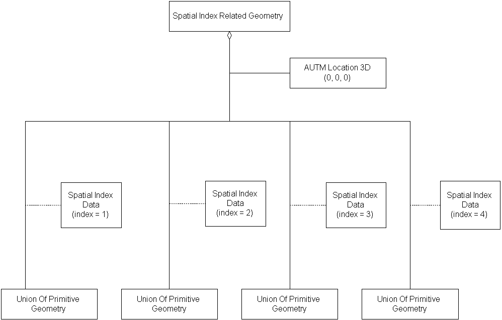
Since the origin of the collection (its lower-left corner, the <TM Augmented 3D Location> is (0, 0, 0), the coverages of the branches are:
- from (0, 0) to (1000, 1000)
- from (1000, 0) to (2000, 1000)
- from (2000, 0) to (3000, 1000)
- from (3000, 0) to (4000, 1000)
Consider a triangular <Polygon> in branch #2 of this aggregation, with <Vertex> <Location> instances (1995, 0, 0), (2005, 0, 0) (2005, 10, 0).
Since this <Polygon> crosses the boundary between branch #2 and branch #3, this <Spatial Index Related Geometry>'s strict_organizing_principle shall be set to SE_FALSE.
Consider a <Spatial Index Related Features> with row_count = 1, column_count = 4, row_width = 1000 metres, column_width = 500 metres. For simplicity, each of the 4 branches of the <Spatial Index Related Features> instance in this example is a <Union Of Features> instance.
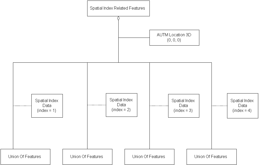
Since the origin of the collection (its lower-left corner, the <TM Augmented 3D Location> is (0, 0, 0), the coverages of the branches are:
- from (0, 0) to (500, 1000)
- from (500, 0) to (1000, 1000)
- from (1000, 0) to (1500, 1000)
- from (1500, 0) to (2000, 1000)
(Note that a <Spatial Index Related Features> does not specify the range of z/height/elevation values.)
Consider a triangular <Areal Feature> in branch #2 of this aggregation, consisting of one regular <Feature Face>, which in turn has an external Feature Face Ring containing 3 <Feature Edge> instances as follows:
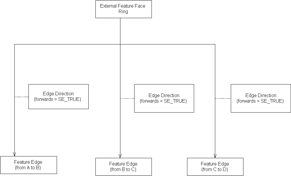
Since the <Areal Feature> thus crosses the boundary between branch #2 and branch #3, the <Spatial Index Related Features>' strict_organizing_principle shall be set to SE_FALSE.