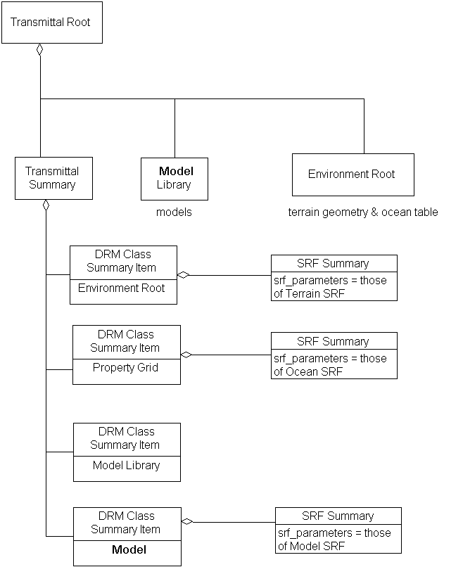
Consider a transmittal containing terrain geometry, an oceanographic <Property Grid> and a number of <Model> instances. The terrain is in one spatial reference frame, the <Property Grid> in another, and some of the <Model> instances in a third (in this example, LSR).